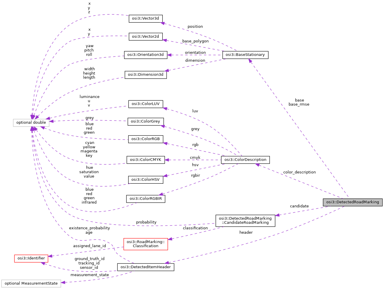
osi3::DetectedRoadMarking Struct Reference
Classes
| struct | CandidateRoadMarking |
| A candidate for a detected road marking as estimated by the sensor. More... | |
Public Attributes
| optional DetectedItemHeader | header = 1 |
| Common information of one detected item. More... | |
| optional BaseStationary | base = 2 |
| The base parameters of the road marking. More... | |
| optional BaseStationary | base_rmse = 3 |
| The root mean squared error of the base parameters of the detected road marking. More... | |
| repeated CandidateRoadMarking | candidate = 4 |
| A list of candidates for this road marking as estimated by the sensor. More... | |
| optional ColorDescription | color_description = 5 |
| The visual color of the material of the road marking. More... | |
Detailed Description
A road marking in the environment as detected by the sensor.
The figure shows two STOP road markings (DetectedRoadMarking::CandidateRoadMarking::classification). STOP RoadMarking::Classification::type == RoadMarking::Classification::TYPE_TEXTUAL_TRAFFIC_SIGN is marked, STOP RoadMarking::Classification::type == RoadMarking::Classification::TYPE_SYMBOLIC_TRAFFIC_SIGN is not marked.
The parent frame of a detected road marking is the virtual sensor coordinate system.
/note The virtual sensor coordinate system is relative to the vehicle coordinate system which has its origin in the center of the rear axle of the ego vehicle. This means if virtual sensor mounting position and orientation are set to (0,0,0) the virtual sensor coordinate system coincides with the vehicle coordinate system.
Member Data Documentation
◆ header
| optional DetectedItemHeader osi3::DetectedRoadMarking::header = 1 |
Common information of one detected item.
◆ base
| optional BaseStationary osi3::DetectedRoadMarking::base = 2 |
The base parameters of the road marking.
The orientation of the bounding box base BaseStationary::orientation is defined as follows: The z-axis of the BaseStationary::orientation is the vector from the 'bottom' to the 'top' of the road marking's (i.e. painted traffic sign) 2D image area. (Normally it is in the ground truth xy-plain.) The x-axis of the BaseStationary::orientation is the view normal of the road marking's 2D image area. Normally this x-axis points to the sky.
- Note
- If a valid unidirectional road marking is assigned to the host vehicle's current lane and the driving direction of the latter roughly matches the z-axis of the
baseBaseStationary::orientationthen the road marking is of relevance to (i.e. in effect for) the host vehicle.
◆ base_rmse
| optional BaseStationary osi3::DetectedRoadMarking::base_rmse = 3 |
The root mean squared error of the base parameters of the detected road marking.
RoadMarking::base has to be identical for all candidate road markings.
◆ candidate
| repeated CandidateRoadMarking osi3::DetectedRoadMarking::candidate = 4 |
A list of candidates for this road marking as estimated by the sensor.
◆ color_description
| optional ColorDescription osi3::DetectedRoadMarking::color_description = 5 |
The visual color of the material of the road marking.
- Note
- This does not represent the semantic classification but the visual appearance. For semantic classification of the road marking use the color field in
CandidateRoadMarking::classification.
- osi_detectedroadmarking.proto