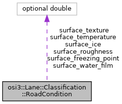
osi3::Lane::Classification::RoadCondition Struct Reference
Public Attributes
| optional double | surface_temperature = 1 |
| The temperature of the roads surface in Kelvin. More... | |
| optional double | surface_water_film = 2 |
| The height of the water film on top of the surface in mm. More... | |
| optional double | surface_freezing_point = 3 |
| The temperature where the water on top of the surface would start to freeze or dew in Kelvin. More... | |
| optional double | surface_ice = 4 |
| The percentage of ice covering the road. More... | |
| optional double | surface_roughness = 5 |
| The coefficient representing the roughness or unevenness of the road. More... | |
| optional double | surface_texture = 6 |
| The surface texture or fine roughness. More... | |
Member Data Documentation
◆ surface_temperature
| optional double osi3::Lane::Classification::RoadCondition::surface_temperature = 1 |
The temperature of the roads surface in Kelvin.
Unit: K
- Rules
- is_greater_than_or_equal_to: 0
◆ surface_water_film
| optional double osi3::Lane::Classification::RoadCondition::surface_water_film = 2 |
The height of the water film on top of the surface in mm.
Unit: mm
- Rules
- is_greater_than_or_equal_to: 0
◆ surface_freezing_point
| optional double osi3::Lane::Classification::RoadCondition::surface_freezing_point = 3 |
The temperature where the water on top of the surface would start to freeze or dew in Kelvin.
Unit: K
- Rules
- is_greater_than_or_equal_to: 0
◆ surface_ice
| optional double osi3::Lane::Classification::RoadCondition::surface_ice = 4 |
The percentage of ice covering the road.
Unit: %
- Rules
- is_greater_than_or_equal_to: 0
◆ surface_roughness
| optional double osi3::Lane::Classification::RoadCondition::surface_roughness = 5 |
The coefficient representing the roughness or unevenness of the road.
International Roughness Index (IRI) [1] values range from 0 = smooth ground (equivalent to driving on a plate of glass) up to
20 mm/m (a very rough road).
Estimated value ranges (IRI): 0.0 mm/m absolutely perfect evenness 0.3 - 1.8 mm/m airport runways and superhighways 1.4 - 3.4 mm/m new pavements 2.2 - 5.7 mm/m older pavements 3.2 - 9.8 mm/m maintained unpaved roads 4.0 - 11.0 mm/m damaged pavements 8.0 - > 20 mm/m rough unpaved roads
Speed of normal use (IRI): 30 km/h - 20 mm/m 50 km/h - 14.5 mm/m 60 km/h - 10.0 mm/m 80 km/h - 8.5 mm/m 100 km/h - 3.4 mm/m
Road conditions (IRI); 15 mm/m erosion gulleys and deep depressions 11 mm/m frequent shallow depressions, some deep 9 mm/m frequent minor depressions 5 mm/m surface imperfections
Unit: mm/m
- Reference:
- [1] Sayers, M. W. & Karamihas, S. M. (1998). Little Book of Profiling. University of Michigan Transportation Research Institute. Retrieved January 25, 2020, from http://www.umtri.umich.edu/content/LittleBook98R.pdf pp. 45 ff.
- Rules
- is_greater_than_or_equal_to: 0
◆ surface_texture
| optional double osi3::Lane::Classification::RoadCondition::surface_texture = 6 |
The surface texture or fine roughness.
Whereas the IRI-based roughness or unevenness measure only takes into account road wavelengths around 0.5 m - 100 m, the surface texture or fine roughness [1] measures only wavelengths below 0.5 m. It is given as the standard height deviation of fine roughness
Unit: m
- Reference:
- [1] Schneider, R. (1998). Modellierung der Wellenausbreitung fuer ein bildgebendes Kfz-Radar. PhD thesis. Karlsruhe, Germany. Universitaet Karlsruhe, Fak. f. Elektrotechnik.
- osi_lane.proto
