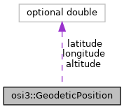
osi3::GeodeticPosition Struct Reference
Detailed Description
The geodetic position of an object, that is, the center of the 3D bounding box.
Member Data Documentation
◆ longitude
| optional double osi3::GeodeticPosition::longitude = 1 |
Longitude in decimal degrees regarding WGS84.
Unit: Degree Range: [-180; 180]
◆ latitude
| optional double osi3::GeodeticPosition::latitude = 2 |
Latitude in decimal degrees regarding WGS84.
Unit: Degree Range: [-90; 90]
◆ altitude
| optional double osi3::GeodeticPosition::altitude = 3 |
Height above sea level regarding EGM96.
Unit: m Range: [-300; 10000]
- osi_common.proto
